


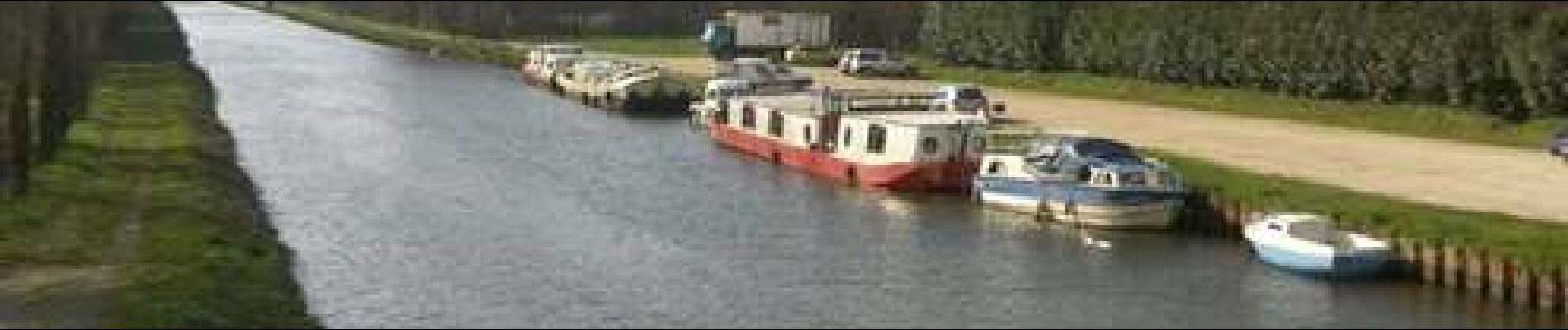
Chavagne_Ecluse de Cicé
© OpenStreetMap contributors


--
Difficulty : Easy


Length
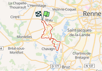
18.6 km
Max alt
43 m
Uphill gradient
100 m
Km-Effort
20 km
Min alt
17 m
Downhill gradient
101 m
Boucle
Yes
Creation date :
2021-04-20 09:30:52.976
Updated on :
2021-04-20 19:28:10.306
--
Difficulty : Easy
FREE GPS app for hiking
 SityTrail
IGN / Geographical institutes
SityTrail Plus
The world is yours!
About
Trail Cycle of 18.6 km to be discovered at Brittany, Ille-et-Vilaine, Le Rheu. This trail is proposed by yannick.juin@orange.fr.
Description
Route de campagne
Bord de La Vilaine Ecluse de Cicé
passerelle au-dessus de la Vilaine
Photos


Positioning
Country:
France
Region :
Brittany
Department/Province :
Ille-et-Vilaine
Municipality :
Le Rheu
Location:
Unknown
Start:(Dec)
Start:(UTM)
589048 ; 5328097 (30U) N.
Comments